Austin Zoning: 3 Reforms Buyers, Investors & Developers Must Verify
Quick Austin zoning checklist to verify entitlements after 2023–2026 reforms. What buyers and investors must check before closing.
Austin Zoning: 3 Reforms Buyers, Investors & Developers Must Verify
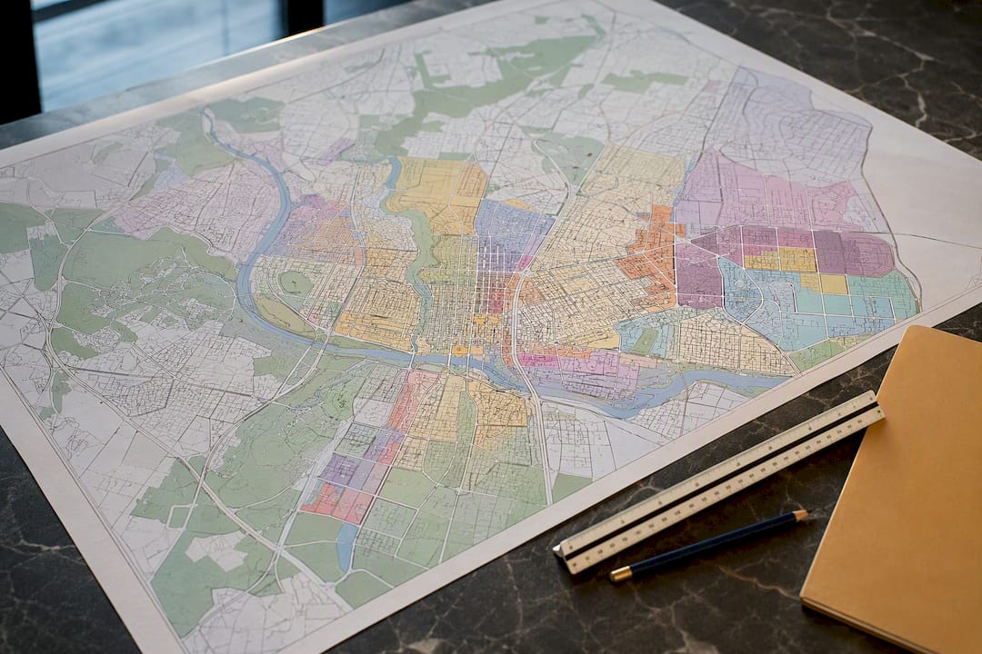
Austin zoning controls permitted uses, height, setbacks, and density on every parcel in the city. Before you buy, build, or plan a renovation, confirm the parcel’s zoning on the City of Austin’s GIS or request a Zoning Verification Letter. Recent reforms have changed entitlements citywide, so a five-year-old assumption about what a lot allows can now be wrong.
TL;DR:
- Zoning reforms since 2023 have increased entitlements, making outdated assumptions about lot allowances potentially inaccurate.
- Austin’s zoning has two layers: base districts and overlays or combining districts, which can significantly restrict or expand permitted uses.
- Checking parcel-specific zoning requires official city records and should include review of overlays, conditional restrictions, and site development standards before planning.
- Recent changes, such as the HOME Initiative and compatibility rule reforms, have altered what small residential and commercial parcels can develop or subdivide.
- Rezoning and variance processes are complex, time-consuming, and heavily influenced by neighborhood sentiment, requiring thorough due diligence before purchase or development plans.
Table of Contents
- How Austin’s Zoning System Is Structured
- How to Check the Zoning for a Specific Property
- Site Development Rules That Determine What You Can Build
- What Recent Zoning Reforms Changed for Austin Property Owners
- How Does the Rezoning and Variance Process Work?
- Due-Diligence Checklist Before You Buy or Develop
- Where to Verify Austin Zoning Information Officially
- How zoning checks are applied for clients
- Sources
- FAQ
How Austin’s Zoning System Is Structured
Austin zoning works in two layers: a base district that sets the fundamental use and intensity, and combining or overlay districts that modify it. The city maintains 39 base zoning districts spread across residential, commercial, industrial, and special-purpose categories, and up to 13 combining districts can stack on top of a base zoning designation to restrict or expand what’s allowed.
Reading a zoning label is mostly about decoding abbreviations. Once you know the shorthand, a string like “SF-3-NP” stops looking like a code and starts looking like information.
- SF (single family) and MF (multifamily): residential districts, numbered by density (SF-1 through SF-6, MF-1 through MF-6).
- CS (commercial services) and GR (community commercial): general retail and service uses.
- LO (limited office) and GO (general office): office-only or office-plus-limited-commercial uses.
- CBD (central business district): downtown’s highest-intensity commercial core.
- CO: conditional overlay, a customized restriction attached to a specific case.
- NCCD: neighborhood conservation combining district, often tied to a neighborhood plan.
- PUD: planned unit development, a negotiated, site-specific set of rules.
- VMU and ETOD: vertical mixed-use and equitable transit-oriented development overlays that encourage density near corridors and transit stations.
The Permitted Use Chart in Chapter 25-2 is where all of this gets tested against a specific use. Each use, like “restaurant (general)” or “duplex residential,” gets a letter in every zoning column: P for permitted by right, C for conditional (requires a separate permit and review), or a dash for prohibited outright.
How to Check the Zoning for a Specific Property
Never rely on a listing description, a neighbor’s opinion, or what the lot next door looks like. Zoning is a legal fact tied to a parcel, and you verify it through the city’s own records.
- Open the Austin Property Profile / GIS tool and search the address or parcel ID. Record the base zoning designation, any combining districts, and the parcel’s exact boundaries.
- Note the ordinance number and adoption date tied to the current zoning. This matters because a parcel rezoned in 2019 under different rules can behave differently than one rezoned in 2025.
- Cross-reference the base district against the Permitted Use Chart to confirm your intended use is a “P” and not a “C” requiring extra approval.
- Check the site development standards tables for height, setback, and lot coverage limits tied to that district.
- For anything beyond casual research, especially before closing or filing permits, submit a formal request through the city’s Zoning Verification Letter process, or email the Development Services Department’s zoning review team directly at DSDZoningSitePlan@austintexas.gov.
Pro Tip: Save the PDF of your GIS search results and the parcel’s ordinance history the day you pull them. Zoning maps get updated, and having a dated snapshot protects you if a dispute comes up later about what the property allowed at the time you looked.
Also check for recorded conditional overlays (COs) on the parcel. A base zoning of GR looks permissive until you discover a CO restricting drive-through uses or capping building height below what the base district would otherwise allow.
Site Development Rules That Determine What You Can Build
Four numbers decide most of a property’s real development potential: floor-to-area ratio, height limit, setbacks, and minimum lot size. Get any one of them wrong in your planning and a project that looked profitable on paper stops working.
Floor-area ratio (F.A.R.) measures gross building floor area divided by total lot area, so an F.A.R. of 0.4 on a 10,000-square-foot lot caps you at 4,000 square feet of building. Height limits vary sharply by district, from roughly 35 feet in many single-family zones up to hundreds of feet downtown. Setbacks define how far a structure must sit from front, side, and rear property lines, and minimum lot size determines whether a parcel can be subdivided at all.
Development math in practice: A parcel’s F.A.R., height cap, and lot size interact directly. A large lot with a low F.A.R. often has more buildable square footage than a small lot with a generous F.A.R., which is why comparing districts on a single metric alone is a mistake buyers make constantly.
A few rules deserve special attention because they’ve shifted recently and change the calculus for smaller residential lots:
- ADU rules have loosened in several residential districts, and Mogaverogroup’s own analysis of Austin’s ADU regulations breaks down where a second unit is now realistic on a standard lot.
- Minimum off-street parking requirements have been removed citywide for most uses, which changes the math on smaller infill lots that previously lost buildable area to a parking pad.
- Impervious cover limits, capping the percentage of a lot covered by buildings, driveways, and pavement, still apply and often bind tighter than height or setback limits on smaller lots, especially in watershed-protected areas.
Overlays and COs can override any of these base numbers, which is exactly why the site development standards guide tells you to check both the base district table and any recorded case-specific conditions before finalizing a project budget.
What Recent Zoning Reforms Changed for Austin Property Owners
If your knowledge of Austin zoning predates 2023, treat it as outdated. Three separate reform tracks have materially changed what many residential and commercial lots allow, and each one affects entitlement value differently.
- The HOME Initiative rolled out in two phases. Phase 1 allowed up to three housing units on lots previously zoned for one home. Phase 2 reduced minimum lot sizes for subdivision, opening the door to smaller, more numerous lots in areas that used to support only large single-family parcels.
- Compatibility standards reform reduced the trigger distances that force height and setback restrictions near single-family zoning. Commercial and multifamily parcels that once faced compatibility limits from a single-family lot several hundred feet away may now build taller, closer to that boundary, because the buffer zone shrank.
- State preemption developments at the Texas legislative level are pushing toward allowing multifamily housing by right in some commercial zones, without a local rezoning case. This is an evolving area, and the practical effect on any specific parcel should be confirmed with current City of Austin planning guidance or a land use attorney, not assumed from a headline.
These three shifts stack. A commercial lot near single-family housing that was capped by compatibility rules two years ago, and now sits in a zone where multifamily use may be allowed by right, can carry meaningfully different entitlement value today than it did before 2023. Verify current status before pricing any development deal on old assumptions.
How Does the Rezoning and Variance Process Work?
Rezoning a parcel in Austin is a public, multi-step process, not an administrative formality. It typically runs several months from application to final decision, longer when a case draws organized neighborhood opposition.
- Application and case assignment. You file with the Planning Department, and the case gets assigned to a staff case manager who becomes your primary point of contact.
- Staff review and report. Staff evaluates the request against the neighborhood plan and code, then publishes a formal recommendation.
- Land Use Commission hearing. The Zoning and Platting Commission or Planning Commission holds a public hearing, where neighborhood associations and individual residents can testify and, in some cases, trigger a valid petition that raises the council vote threshold.
- City Council readings. The council typically hears the case across multiple readings before a final vote, with additional public comment at each stage.
Budget for more than the rezoning application fee itself. Surveys, traffic or drainage studies, and legal or planning consultant fees often cost more than the application, particularly when a conditional overlay gets negotiated to address neighborhood concerns. Petition rights genuinely change outcomes, even when a staff report is favorable, so gauging neighborhood sentiment early is worth as much as the technical case itself.
Due-Diligence Checklist Before You Buy or Develop
Run this before you write an offer or commit money to entitlement work. Skipping any one item is how buyers end up owning a lot that can’t do what they planned.
- Pull the parcel ID, current base zoning, and every combining district or overlay attached to it.
- Run the intended use through the Permitted Use Chart and confirm a “P,” not a “C” you’re assuming will get approved.
- Request copies of any recorded conditional overlays, deed restrictions, or prior variance approvals tied to the parcel.
- Ask the listing agent and seller directly about pending code violations, active zoning cases, or unresolved permits.
- Contact the Planning Department case manager if any zoning case on the parcel is still open.
Pro Tip: Watch for two opposite signals: an unrecorded overlay or an expired ordinance is a red flag worth walking away from, while a transit overlay like ETOD or a density-bonus program nearby can be genuine upside that raises long-term resale and development value. A neighborhood guide like the East Austin overview shows how these overlays play out differently block by block, even within the same general area.
Where to Verify Austin Zoning Information Officially
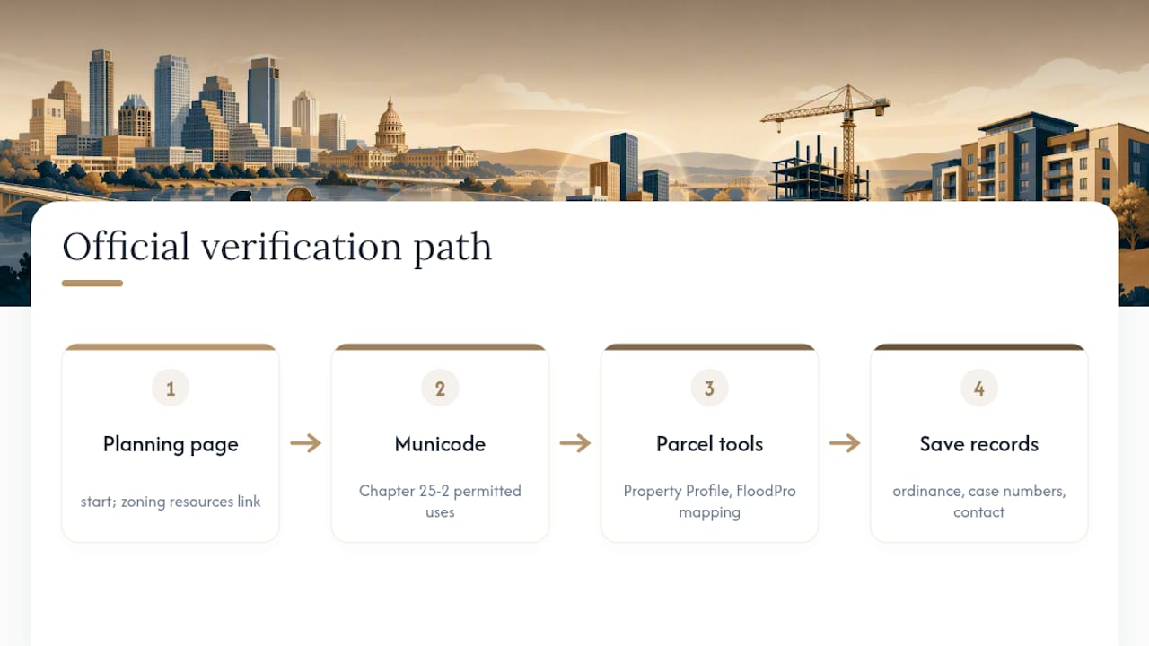
Every claim in this guide traces back to a handful of official sources, and you should bookmark them rather than rely on secondhand summaries. The City of Austin Planning zoning page is the starting point for general navigation. Zoning Resources & Site Regulations covers overlay descriptions and links the Zoning Verification Letter application. Chapter 25-2 on Municode holds the actual legal text and permitted-use tables. The zoning guide PDF translates that code into readable tables for heights, setbacks, and lot sizes.
For parcel-specific lookups, use the Property Profile / GIS tool and FloodPro mapping for floodplain and drainage overlays. If you’re comparing this to how other jurisdictions publish planning maps, this primer on reading municipal zoning maps is a useful outside reference for the general skill of interpreting official land-use documents. Save ordinance numbers, case numbers, and your case manager’s contact information for anything active.
How zoning checks are applied for clients
Zoning verification is treated as an important first technical step before advising a buyer on an off-market lot or a pre-construction opportunity, because a parcel’s actual entitlements, not its listing description, determine whether a project pencils out.
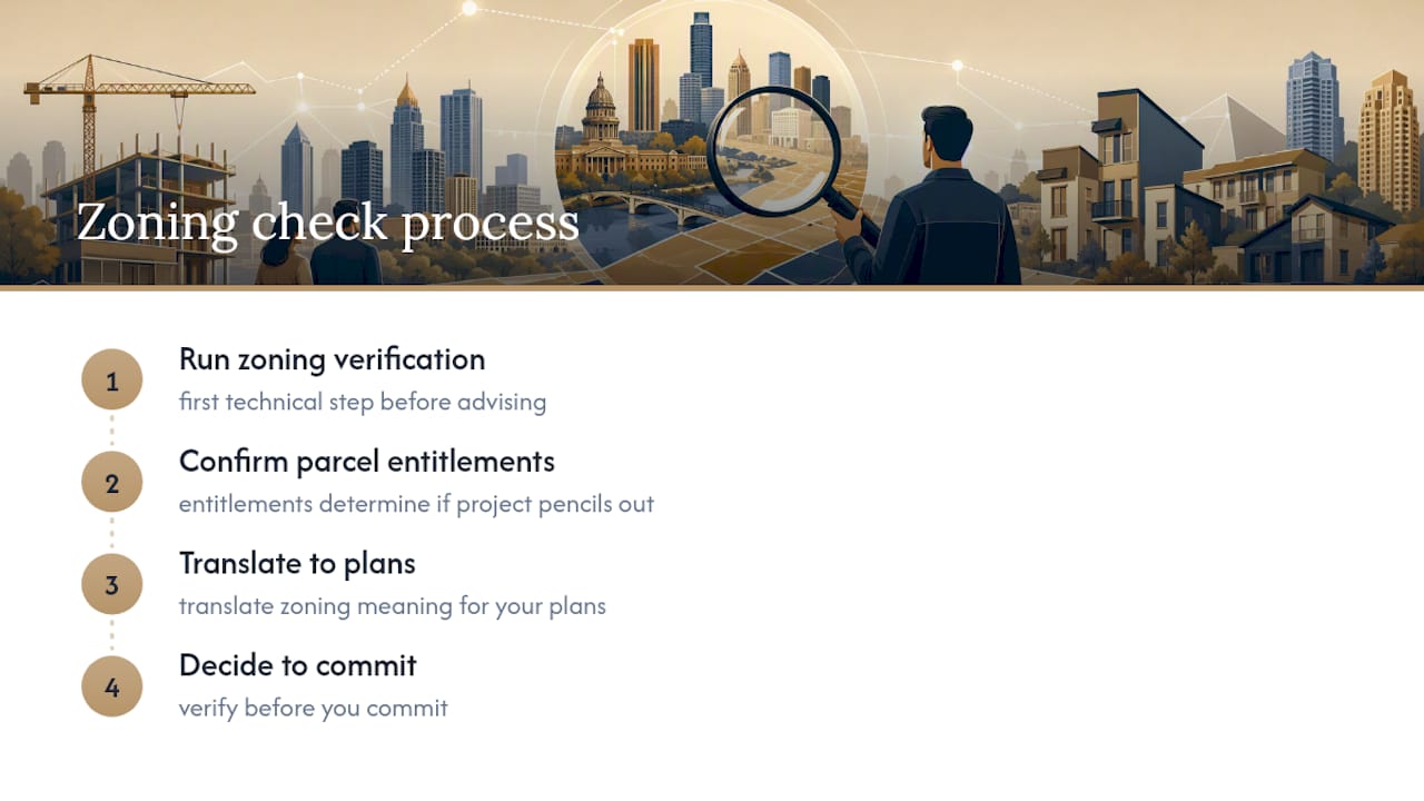
Mike Mogavero built this approach on the same principle running through this entire guide: verify before you commit. If you’re evaluating a specific parcel, whether it’s a listed property or one of our private, off-market Austin listings, we’ll run the zoning check with you and translate what it actually means for your plans.
— Mike
Sources
FAQ
How Can I Check the Zoning of My Property in Austin?
Search your address or parcel ID on the Austin Property Profile / GIS tool, which returns the base zoning designation and any overlays. For anything legally significant, follow up with a formal Zoning Verification Letter request through the Planning Department.
What Are the Different Zoning Classifications in Austin?
Austin uses 39 base zoning districts across residential (SF, MF), commercial (CS, GR, CBD), office (LO, GO), industrial, and special-purpose categories, plus combining districts like NCCD and PUD that can modify the base rules.
What Do the Zoning Codes for Austin City Mean?
Each code combines a base district abbreviation (like SF-3 for single-family) with any applicable combining district suffix (like NP for neighborhood plan area or CO for conditional overlay); the full legal definitions live in Chapter 25-2 of the city code.
Does Zoning Affect Which Austin Areas Are Worth Avoiding?
Zoning itself doesn’t label an area good or bad, but unresolved code violations, industrial-adjacent commercial zoning, or lots burdened by restrictive conditional overlays can signal lower resale or development potential; run the due-diligence checklist above on any specific parcel before drawing conclusions about a neighborhood.
How Does Zoning Affect Property Taxes in Austin?
Zoning shapes a property’s highest and best use, which appraisal districts factor into market value assessments; a parcel rezoned for higher-density or commercial use often sees its appraised value, and resulting tax bill, rise to reflect that added development potential.