Impervious Cover in Austin: Limits, Fees, and How to Calculate It
Discover how impervious cover in Austin impacts your property. Learn about limits, fees, and calculation methods to manage your costs effectively.
Impervious Cover in Austin: Limits, Fees, and How to Calculate It
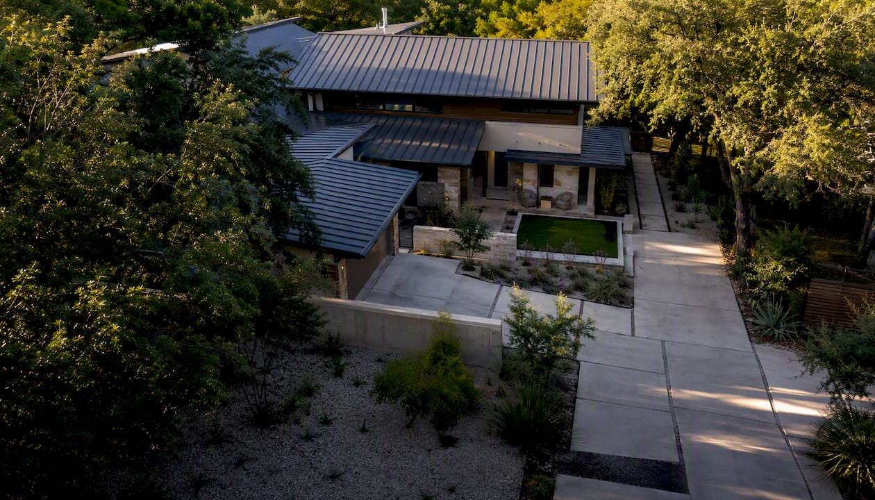
Impervious cover in Austin is the percentage of your lot covered by anything that stops rain from soaking into the ground: roofs, driveways, patios, parking areas. The City measures it under Land Development Code §25‑1‑23, and that number controls three things you actually care about — whether your project needs a site plan review, how close you are to your watershed’s cap, and how much you pay every month through the City’s drainage charge.
That last part surprises a lot of new Austin owners. This isn’t a one-time permitting hurdle. It’s a recurring line item on your utility bill, and it scales with square footage of hard surface, not with your home’s value or your water usage.
Before you do anything else, pull up two City resources: the Impervious Cover 2023 dataset to see what the City has on file for your parcel, and the Drainage Charge page to check the current rate and run an estimate.
- Definition source: Land Development Code §25‑1‑23 and §25‑8‑63, cross-referenced with the Environmental Criteria Manual (ECM)
- What it controls: permit path, watershed‑specific coverage caps, and your monthly drainage charge
- What to check first: your parcel’s recorded impervious square footage on the City’s Open Data map
The number that matters most right now: Austin’s drainage charge base rate runs $0.00593 per square foot of impervious area per month, so a typical single-family lot with several thousand square feet of impervious cover pays a modest monthly fee based on that area, on that line alone.
Key Takeaways
Impervious cover in Austin determines your permit path, your watershed coverage cap, and a recurring monthly drainage charge calculated at $0.00593 per square foot.
| Point | Details |
|---|---|
| Check both limits | Compare your zoning coverage cap and your watershed impervious limit; the lower one applies. |
| Measure carefully | Use net site area and horizontal footprints, and apply ECM partial-count rules to decks and ambiguous surfaces. |
| Budget the drainage charge | At the current per square foot monthly rate, a typical 3,150 square foot single-family lot pays a proportional annual amount. |
| Plan mitigation early | Coordinate permeable materials, GSI, and sidewalk credits with a drainage reviewer before finalizing design. |
| Get local guidance | Mogavero Group connects buyers and developers with engineers and off-market inventory already screened for site constraints. |
Table of Contents
- What Counts as Impervious Cover Under Austin Code?
- How Do You Calculate Impervious Cover for Your Lot?
- What Are the Impervious Cover Limits by Zone and Watershed?
- How Does the Drainage Charge Work and What Will You Pay?
- What Permits or Variances Do You Need for Impervious Cover?
- How Can You Reduce or Offset Impervious Cover?
- Where Do You Find Official Impervious Cover Data and Tools?
- What Should Buyers and Developers Watch for Locally?
- A Local Perspective on What This Means for Your Property
- Sources
- FAQ
What Counts as Impervious Cover Under Austin Code?
Roofs, driveways, sidewalks, patios, parking lots, and roadways all count as impervious cover under the City of Austin’s development glossary, which defines it as any surface that prevents water from infiltrating the soil. The Land Development Code’s Division 4 (Impervious Cover Determinations) governs how these areas get calculated, and the Environmental Criteria Manual fills in the measurement details that the code text leaves general.
Most people assume it’s just their house and driveway. It’s not that simple.
- Fully counted: roofs (including overhangs in most cases), driveways, sidewalks, patios, parking pads, tennis or sport courts, and any poured concrete or asphalt surface.
- Partially counted or conditional: uncovered wood decks over pervious soil, which can count at a reduced fraction of their horizontal area rather than the full footprint.
- Typically excluded: swimming pools, ponds, fountains, and gravel used strictly as landscaping over pervious ground, based on measurement guidance in the City’s Title 25 WPO documentation.
The gray areas are where projects get delayed. Permeable pavers, decking built over compacted base rock instead of native soil, and green roofs all get treated differently depending on what’s underneath them and how they’re constructed.
Pro Tip: If your project includes permeable pavers, a deck overengineered fill, or anything that isn’t a straightforward slab, get a civil engineer or licensed surveyor to run the measurement against the ECM rules before you submit. A wrong assumption here doesn’t just cost you a resubmittal fee, it can shift your entire site layout.
How Do You Calculate Impervious Cover for Your Lot?
Calculating impervious cover is a matter of dividing total hard-surface area by your net site area, but getting the inputs right takes a few careful steps.
- Establish net site area. This is your lot’s total area minus any dedicated right-of-way or easement area the code excludes from the calculation.
- Identify every impervious feature. Walk the property (or the site plan) and list the roof footprint, driveway, walkways, patios, any accessory structures, and parking areas.
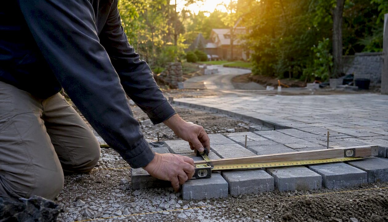
- Measure horizontal area for each feature. Use the projected footprint, not the sloped surface area, and apply the ECM’s partial-count rules to decks or ambiguous surfaces.
- Sum all impervious areas. Add every fully counted and partially counted feature together.
- Divide by net site area and multiply by 100. That gives you percent impervious cover, the figure the City compares against your zoning and watershed limits.
Here’s how that plays out on a real lot. Say you own a 6,250 square foot parcel in a standard single-family zone. Your house roof covers 2,100 square feet, the driveway and front walk add 650 square feet, and a rear patio adds 400 square feet. That’s 3,150 square feet of impervious cover, or about half of the lot.
At the current drainage charge rate per square foot per month, that 3,150 square feet results in a proportional monthly charge, tacked onto your utility bill regardless of the zoning question.
Pro Tip: The City’s Open Data impervious layer is a fast, free way to sanity-check a parcel before you make an offer or start design. But it’s a modeled estimate, not survey-grade. Once you’re past the “is this feasible” stage and into permitting, order a certified survey. If your drainage charge estimate looks wrong, you can request a correction through the City’s administrative review process.
What Are the Impervious Cover Limits by Zone and Watershed?
Your actual cap is whichever number is lower: your zoning district’s lot coverage limit or your watershed’s impervious cover limit. Many owners check only zoning and miss the watershed constraint entirely, which is often the tighter one.
Austin’s environmentally sensitive watersheds, especially the Barton Springs Zone, carry stricter caps than standard urban zoning because runoff there feeds directly into aquifer recharge and Barton Springs Pool.
| Category | Typical impervious cover limit | Notes |
|---|---|---|
| Standard single-family (SF‑2/SF‑3) | Moderate to high percentage of lot area | Confirm exact figure against current zoning ordinance for the specific district |
| Multifamily zoning | Varies by district with higher permitted percentages | Site plan review typically required |
| Commercial zoning | High percentage depending on district | Subject to drainage and site plan requirements |
| Barton Springs Zone (watershed overlay) | Substantially reduced for undeveloped tracts | Some existing lots grandfathered at higher legal levels; verify with Watershed Protection staff |
Confirm the precise percentage for your parcel against the current Land Development Code and the Environmental Criteria Manual rather than relying on a table like this one, since watershed overlays and zoning amendments shift over time.
- Sidewalk credits can allow limited exceedance when you build porous sidewalks or curb cuts that meet City infiltration standards.
- Credits differ from exemptions: a credit offsets your counted area under specific conditions, while an exemption removes a feature from the calculation entirely.
- Practitioners note that watershed protection rules frequently function as the real controlling constraint on a site, more restrictive than the base zoning entitlement most buyers assume applies.
How Does the Drainage Charge Work and What Will You Pay?
Austin bills every developed parcel a monthly drainage charge based on how much impervious area it carries, using a rate published on the Drainage Charge page. The current base rate is $0.00593 per square foot of impervious cover per month. It shows up on your combined utility bill alongside water and wastewater, not as a separate invoice, which is why a lot of owners never notice it until they read the bill line by line.

The math is simple once you have your impervious square footage: multiply total impervious area by the rate, and that’s your monthly charge.
These figures scale linearly, so a redevelopment that adds 1,500 square feet of new driveway and patio area adds roughly $8.90 a month, or about $107 a year, to that specific charge regardless of anything else on your utility bill.
The charge funds the City’s flood control and erosion mitigation work, which ties directly back to why the limits exist in the first place. Austin operates under an MS4 stormwater permit that requires the City to manage runoff volume and water quality, and impervious surfaces are the primary driver of both. More hard surface means faster, higher-volume runoff, which means more erosion and more flood risk downstream.
If your bill’s impervious figure looks off compared to your own measurement, you can file for an administrative review and request a correction with survey documentation.
What Permits or Variances Do You Need for Impervious Cover?
Whether you need a full site plan review, an administrative variance, or nothing beyond a standard building permit depends on how close your project pushes toward the applicable cap and what kind of property you’re working with.
- Standard building permit: typically sufficient for a single-family remodel that stays comfortably under the applicable limit.
- Site plan review: generally triggered for new construction, subdivisions, or any project crossing defined size or coverage thresholds tied to drainage and stormwater review.
- Administrative variance: an option when a project modestly exceeds a limit and can demonstrate mitigation, such as GSI features or sidewalk credits.
- Land Use Commission request: reserved for larger variance requests that administrative staff can’t approve on their own.
If you’re pursuing a variance, plan for a multi-step path rather than a quick sign-off:
- Order a current survey showing existing and proposed impervious area.
- Prepare a drainage report demonstrating how the project manages runoff, referencing ECM compliance standards.
- Submit the variance request with supporting technical documents to Watershed Protection.
- Respond to staff comments, which commonly adds weeks to the timeline depending on project complexity.
- Receive administrative approval, or escalate to the Land Use Commission if staff can’t approve it outright.
Larger developments that can’t fit onsite detention or mitigation sometimes look at the Regional Stormwater Management Program, which lets a project meet stormwater obligations through offsite contributions instead of onsite basins, when watershed staff approve it.
How Can You Reduce or Offset Impervious Cover?
Reducing counted impervious area usually comes down to material choice and layout, and Austin’s environmental code updates now require Green Stormwater Infrastructure as the primary water quality method on many projects, which gives owners a real incentive to build this in early rather than bolt it on later.
- Swap a section of standard concrete driveway for permeable pavers, which can reduce counted impervious area depending on base design and infiltration testing.
- Add a bioswale or rain garden to manage runoff from roof downspouts, which supports GSI compliance and can factor into credit discussions.
- Narrow driveway width where the site allows it, cutting square footage directly rather than relying on material substitution.
- Convert a portion of a patio to gravel-over-pervious-soil landscaping rather than poured concrete, where design allows.
- Explore sidewalk credits for porous sidewalk sections that meet City infiltration standards.
A quick before-and-after: replacing 500 square feet of a standard concrete driveway with permeable pavers, assuming the City counts the converted section as non-impervious under current ECM rules, removes that 500 square feet from your total. At the $0.00593 rate, that’s roughly $2.97 a month, or about $36 a year, off your drainage charge, plus whatever room it frees up under your zoning cap.
Pro Tip: Coordinate GSI features with a drainage reviewer before you finalize design, not after. Practitioners who work through this regularly find that sidewalk credits, porous materials, and bioswales only preserve developable area and reduce charges when they’re planned early enough to satisfy the reviewer’s documentation requirements, not added as an afterthought during permitting.
Documentation for a credit request typically includes your survey, a drainage report describing the GSI feature, and manufacturer specifications for any permeable material used.
Where Do You Find Official Impervious Cover Data and Tools?
Skip the third-party estimate sites. Austin publishes everything you actually need directly.
- Impervious Cover 2023 dataset: the City’s authoritative GIS layer for estimating parcel-level impervious area, viewable on the map or downloadable as CSV, KML, or GeoJSON.
- Impervious Cover open data export hub: for developers and engineers who need programmatic access to parcel data across a larger area.
- Drainage Charge page: current rate, methodology, and the online estimator.
- Drainage charge administrative review: where to file if your bill’s impervious figure doesn’t match your own measurement.
- Environmental Criteria Manual: the detailed measurement rules that fill in what the code text leaves general.
- Residential calculation aid spreadsheet: a downloadable tool from the City’s planning pages that helps homeowners estimate impervious area and charge impact without hiring an engineer for a simple remodel.
To pull your own parcel, open the Open Data map, search your address, and the tool will show the recorded impervious footprint the City has on file. That number is a solid starting point, but for anything involving a variance, subdivision, or site plan, a certified survey supersedes it.
What Should Buyers and Developers Watch for Locally?
Impervious cover questions come up constantly in Austin transactions, and they trip up buyers who assume the appraisal district’s lot size and the zoning map tell the whole story. They don’t. A gorgeous lot near Lake Austin can carry a watershed overlay that caps coverage well below what the zoning alone would suggest, and that gap between assumed and actual entitlement changes what you can build and what the lot is worth.
Before you write an offer or break ground, work through this:
- Confirm both the zoning coverage limit and the watershed-specific limit, since the lower one governs.
- Ask for the seller’s or builder’s existing impervious cover calculation, and verify it against a current survey rather than an old one.
- Build drainage charge liability into your carrying-cost math, especially on a larger or commercial parcel where the monthly charge can run into hundreds of dollars.
- Require impervious cover documentation as a contract contingency on any redevelopment or new-construction purchase.
- Plan GSI and permeable materials into the design phase, not as a fix after a variance gets rejected.
Pro Tip: The most common developer mistake we see isn’t a bad design, it’s a pro forma that never accounted for the drainage charge or the true watershed cap. By the time an engineer flags it, the buyer has already closed at a price built on square footage the site can’t actually support.
A Local Perspective on What This Means for Your Property
Impervious cover limits show up in negotiations more than most buyers expect. A lot that looks identical to its neighbor on a plat map can carry a very different build entitlement once you factor in a watershed overlay, and that difference moves price. I’ve seen listings where the seller’s stated “buildable footprint” assumed zoning alone, and the real number, once you layered in the watershed cap, was meaningfully smaller.
That gap matters for design too. Clients chasing a specific pool, motor court, or guest house layout sometimes have to trade square footage in one place to stay under cap in another, and the earlier that tradeoff gets identified, the more design options stay on the table. Waiting until permitting to discover the constraint almost always means a compromised layout or an expensive redesign.
If you’re evaluating a specific lot and want a straight read on how its impervious limits will affect design, feasibility, or resale value, reach out and we’ll walk through it with you.
How Mogavero Group Supports Buyers and Developers on Constrained Sites
Mogavero Group gives you something a standard listing search can’t: a team that flags impervious cover and watershed constraints before you fall in love with a lot, not after your engineer finds the problem. We’re not a permitting firm and we don’t calculate your impervious cover ourselves, but we work alongside the civil engineers, surveyors, and drainage reviewers our clients need, and we know which Austin neighborhoods and watersheds carry the tightest caps before you ever make an offer.

That matters most in areas like Lake Austin and other watershed-sensitive pockets of the city, where two seemingly identical lots can have very different buildable footprints once you factor in coverage limits. Our private listings include off-market properties we’ve already screened for these kinds of site constraints, which saves buyers from discovering a coverage problem three weeks into a contract. If you’re evaluating a specific parcel, browse our current Austin properties or contact us for an initial consultation on how a lot’s impervious limits and drainage charge exposure will affect your budget and design plans.
Sources
- City of Austin Development Services glossary
- Drainage Charge | Austin Watershed Protection
- Impervious Cover 2023 | Open Data | City of Austin, Texas
- WPO: Various Title 25 sections (EDIMS document)
FAQ
Is impervious cover regulated in the City of Austin?
Yes. Austin regulates impervious cover under the Land Development Code and the Environmental Criteria Manual, capping it by zoning district and by watershed, with stricter limits in sensitive areas like the Barton Springs Zone.
What are the impervious cover limits in Travis County outside city limits?
Limits vary outside Austin’s city limits, since unincorporated Travis County follows its own development regulations rather than the City’s Land Development Code; property owners there should confirm applicable rules directly with Travis County rather than assuming City caps apply.
What counts as impervious cover?
Roofs, driveways, sidewalks, patios, parking areas, and paved surfaces all count, while pools, ponds, and gravel landscaping over pervious soil are typically excluded or only partially counted under City measurement rules.
Does Sandra Bullock live in Austin, TX?
Sandra Bullock is widely reported to own property in the Austin area, though her exact residency status isn’t publicly confirmed and isn’t relevant to how impervious cover rules apply to any specific parcel.
How do I check my property’s impervious cover online?
Search your address on the City’s Impervious Cover 2023 Open Data map to view the recorded impervious footprint, then confirm with a certified survey before permitting or a variance request.