10% of Austin Is in a Floodplain. Check Austin Flood Zones on FloodPro
Start with FloodPro's COA layer, then check FEMA for insurance. Address checks, elevation certificates, live flood alerts, and permit risks.
10% of Austin Is in a Floodplain. Check Austin Flood Zones on FloodPro

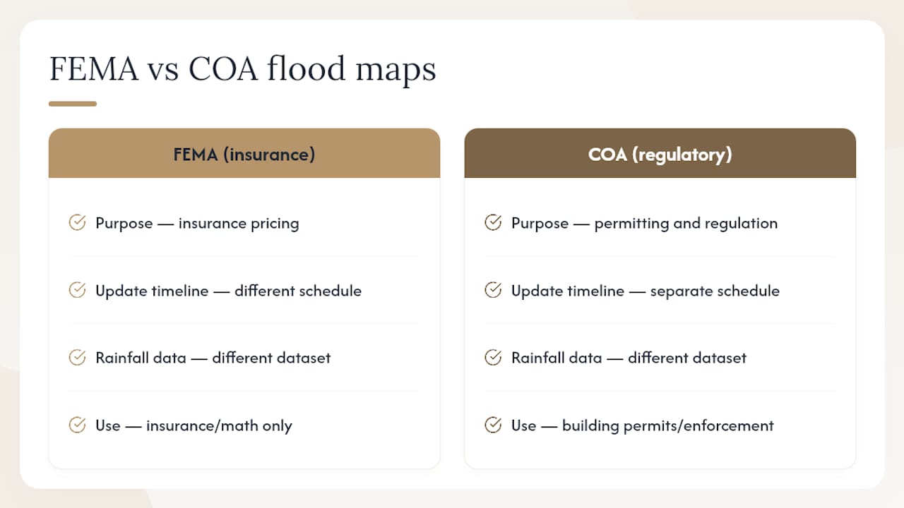
Check your property’s flood status two ways: search the address in FloodPro, the City of Austin’s mapping tool, for regulatory and permitting details, then confirm the same address on the FEMA Flood Map Service Center for the official insurance rating. City of Austin (COA) maps are often stricter than FEMA’s, so a property can be flood-free on one map and restricted on the other.
TL;DR:
- FloodPro provides the most detailed address-level floodplain data for Austin building permits, while FEMA maps are used mainly for insurance purposes.
- A property deemed flood-free on one map could be restricted on the other because city maps are generally stricter than FEMA’s flood zone designations.
- Floodplain labels like 100-year or 500-year do not guarantee no flooding and can still flood multiple times within short periods; awareness of flood risk nuances is crucial.
- An elevation certificate, created by licensed professionals, is essential for accurate flood insurance pricing and should be verified or ordered if outdated.
- Checking flood risk requires reviewing both regulatory city maps for permits and FEMA maps for insurance, as they are independently updated with different rainfall data.
Table of Contents
- Where to Find Official Austin Flood Zone Maps
- How to Check Your Address on FloodPro
- What “100-Year Floodplain” and Other Zone Labels Actually Mean
- Elevation Certificates, LOMAs, and When to Call a Surveyor
- Where to Track Flooding in Real Time
- How Mogavero Group Handles Flood Checks During a Purchase
- The Real Problem With How People Check Flood Risk
- Sources
- FAQ
Where to Find Official Austin Flood Zone Maps
Three sources cover almost every question you’ll have about a specific parcel, and each one answers a different question.
- FloodPro shows both COA regulatory floodplain layers and FEMA layers side by side, lets you print maps, and gives access to floodplain and storm drain model downloads.
- FEMA Flood Map Service Center produces the Flood Insurance Rate Maps (FIRMs) and FIRMettes that lenders and insurers actually use to price a policy or require coverage.
- Travis County floodplain maps matter if the parcel sits in unincorporated county land rather than inside Austin city limits, since county mapping and rules apply there instead of COA’s.
If you’re buying a home, start with FloodPro. It’s built specifically for address-level lookups and shows the layer that decides whether your builder needs a permit variance. If you’re locking in a mortgage or shopping insurance, go straight to FEMA MSC, because that’s the map your lender’s underwriter will pull. About 10% of Austin’s total land area sits inside a mapped floodplain, and the city is actively updating those boundaries using newer NOAA Atlas 14 rainfall data, which is part of why COA and FEMA don’t always agree.
How to Check Your Address on FloodPro
FloodPro’s workflow is simple once you know where to click, but the layer names trip people up the first time through.
- Open FloodPro and locate the “I want to…” menu near the top of the screen.
- Select “Find Floodplain Information” and enter the property’s street address or its parcel number.
- Once the map loads, toggle between the COA layer and the FEMA layer to see whether the two disagree on the parcel.
- Check the floodplain elevation shown for the site against the structure’s finished floor elevation, if that data is available.
- Use the print tool to generate a COA map, a FEMA map, or a custom map, and use the model download option to pull the underlying floodplain or storm drain model for the area, exactly as FloodPro’s help documentation describes.
Pro Tip: Screenshot every layer you view, including the legend, and download the elevation certificate right then if FloodPro shows one on file. Records get updated, and a saved copy protects you if a map revision changes what’s showing next month.
What “100-Year Floodplain” and Other Zone Labels Actually Mean
A 100-year floodplain, also written as Zone AE on FEMA maps, has a 1% chance of flooding in any given year. A 500-year floodplain, sometimes labeled Zone X (shaded), carries a 0.2% annual chance. Neither number promises anything about next year specifically. A “1% chance” zone can flood two years in a row, and it has before.
- Floodway: the channel and adjacent land that carries the fastest, deepest water during a flood event. It’s the highest-risk strip on any map and typically carries the tightest building restrictions.
- Zone AE: FEMA’s standard designation for the 100-year floodplain, used to set mandatory flood insurance requirements under the National Flood Insurance Program.
- Zone X: generally lower risk, covering the 500-year floodplain and areas outside mapped flood hazards, though “lower risk” isn’t “no risk.”
FEMA points out that homeowners in these lower-risk zones are still five times more likely to file a flood claim than a fire claim over a 30-year mortgage term. Austin adds another wrinkle: because Atlas 14 map updates are still in progress, the city is temporarily regulating development against the larger 500-year boundary rather than the smaller FEMA 100-year line, so a parcel can clear FEMA’s insurance map and still trigger COA permit conditions.
Elevation Certificates, LOMAs, and When to Call a Surveyor
An elevation certificate is a sealed document, prepared by a licensed surveyor or engineer, that records a structure’s exact elevation relative to the base flood elevation. It’s the single most useful document for pricing flood insurance accurately.
- Search FloodPro’s records for an existing elevation certificate before assuming you need a new one.
- Check both FloodPro and FEMA MSC for any Letter of Map Amendment (LOMA) or Letter of Map Revision (LOMR) tied to the parcel, since either one can remove or reclassify a property that was mapped incorrectly.
- If no certificate exists, or the one on file predates a recent map revision, order a new survey. It affects your insurance premium and, in some cases, your permit approval.
- If FloodPro’s records look incomplete or contradictory, contact Austin Watershed Protection directly rather than guessing.
Where to Track Flooding in Real Time
Static maps tell you long-term risk. They won’t tell you whether a specific road is underwater right now.
- ATX Floods publishes live road-closure information and camera feeds during active rain events, and it’s the fastest way to see which low-water crossings are closed near you.
- Subscribe to National Weather Service alerts and Travis County’s emergency notification pages so warnings reach your phone before water reaches your street.
- During heavy rain, never drive through a low-water crossing, even one you cross daily. Move vehicles to higher ground early, and follow official evacuation guidance the moment it’s issued rather than waiting to see how bad it gets.
Pro Tip: Bookmark ATX Floods on your phone before storm season, not during it. The site gets slow under heavy traffic exactly when you need it most.
How Mogavero Group Handles Flood Checks During a Purchase
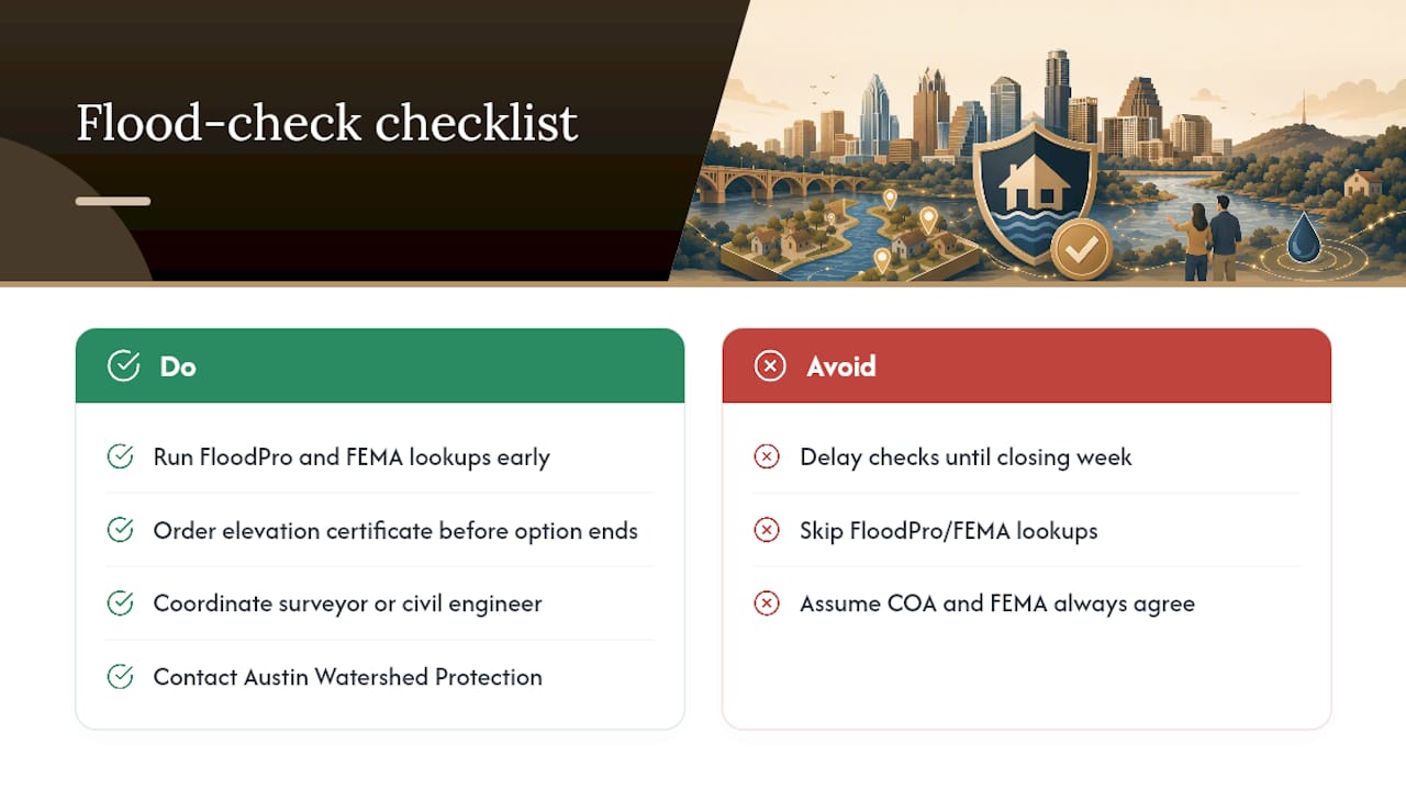
Flood-zone status affects three things in a contract: the inspection contingency, the permitting timeline if you plan to build or renovate, and the insurance budget you’re underwriting the deal against. Skipping the check until closing week is how buyers end up renegotiating price at the worst possible moment.
FloodPro and FEMA lookups should be included in the early due diligence on every Austin property, especially those near Lake Austin, Lady Bird Lake, or the creek corridors that cut through East Austin. When a parcel’s paperwork is thin, we coordinate directly with surveyors and civil engineers to get a fresh elevation certificate before the option period runs out, and we know which Austin Watershed Protection contacts can confirm a zone classification quickly. Mike Mogavero has spent over 20 years reading Austin’s map revisions and knows which neighborhoods tend to see COA and FEMA maps disagree.
The Real Problem With How People Check Flood Risk
Most flood-zone advice online treats “checking the flood zone” as a single lookup, one map, one answer, done. That’s the wrong mental model for Austin specifically. This city runs two systems in parallel: a FEMA map built for insurance pricing and a COA regulatory layer built for permitting, and they’re being updated on different timelines using different rainfall data. Treating either one as the final word is how buyers get surprised at the permit desk after closing.
The conventional advice to “just check if you’re in the floodplain” also undersells how much a Zone X property can still flood. FEMA’s own numbers on flood claims outpacing fire claims should be part of every buyer conversation, not a footnote.
If you take one thing from this, prioritize FloodPro’s COA layer first, since that’s the one that decides your building permit, then confirm the FEMA layer for insurance math, and never assume last year’s elevation certificate still matches this year’s map.
— Mike
Sources
- Austintexas
- FEMA Flood Map Service Center: Search By Address
- FloodPro help file (FloodPro_Help_File.pdf)
Ready to put these checks to work on an actual property search? Browse Mogavero Group’s current listings or ask about off-market Austin properties we can vet for flood history and elevation documentation before you ever tour the house.
FAQ
Is Austin, Texas in a Floodplain?
Parts of it are. About 10% of Austin’s total land area sits within a mapped floodplain, and every creek and lake in the city has a floodplain whether or not it’s fully modeled yet.
Which Flood Zones Are Considered High-Risk?
Zone AE, the 100-year floodplain with a 1% annual flood chance, is high-risk, and the floodway within it carries the highest risk of all because it channels the fastest, deepest water during a flood event.
Was Camp Mystic in a Flood Zone?
Camp Mystic sits in the Texas Hill Country along the Guadalupe River, outside the Austin metro area covered by this guide; readers researching that specific flooding event should consult FEMA’s map records and official Kerr County sources directly rather than Austin’s city mapping tools.