Avoid Costly Redesigns: Austin McMansion Rules After RDCC Removal
Austin Subchapter F: FAR, 32 foot height, 45 degree tent plane. How RDCC removal affects waivers and how to avoid costly redesigns.
Avoid Costly Redesigns: Austin McMansion Rules After RDCC Removal
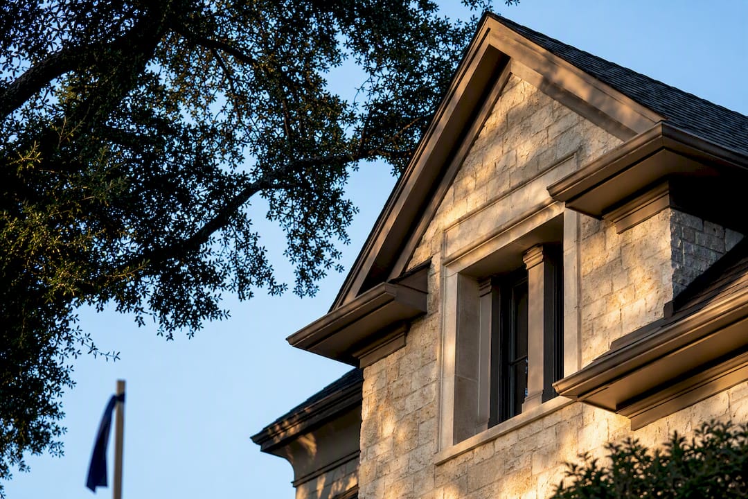
Austin’s McMansion Ordinance, officially Subchapter F of the Land Development Code, still caps residential size and mass across most of the central city. The three controls that matter most are a floor-to-area ratio (FAR) cap, a 32-foot height limit (35 feet in the 100-year floodplain), and a 45-degree “tent” setback plane. Subchapter F remains fully enforceable wherever it’s mapped, though who handles waiver requests has changed following the city’s move to eliminate the Residential Design and Compatibility Commission.
TL;DR:
- The tent setback plane is the most common design obstacle, requiring second-floor plans to slope inward and often prompting costly redesigns.
- The Board of Adjustment now handles waiver requests for projects exceeding limits, but approval is more difficult due to a stricter hardship standard.
- Using early modeling of the tent plane and carefully coordinating garage placement and lot constraints can prevent delays and redesigns during permitting.
- Subchapter F applies only within specific central Austin neighborhoods, primarily affecting single-family, small-lot, townhouse, and accessory dwelling units.
- Confirming applicability requires checking the city’s official map, parcel information, and zoning details before finalizing property choices or design plans.
Table of Contents
- What Does the Austin McMansion Ordinance Actually Limit?
- Where Does Subchapter F Apply in Austin?
- What Changed With the RDCC and Recent Amendments?
- How Does Permitting and Appeals Work Now?
- How Can You Design Around Subchapter F Without a Redesign Later?
- Local Guidance for Buyers and Sellers Navigating Subchapter F
- Which Neighborhoods and Zoning Types Fall Under Subchapter F?
- A Local Take on What Actually Trips People Up
- Sources
- FAQ
What Does the Austin McMansion Ordinance Actually Limit?
Subchapter F works through three interlocking measurements, and a project has to clear all three, not just one.
The floor-to-area ratio cap sets maximum permitted development at a specific floor-to-area ratio or a square footage limit of gross floor area, depending on lot size and zoning. Smaller lots tend to hit the flat ceiling of square footage before the ratio math even becomes relevant, while larger lots calculate against the percentage. Either way, this is the number that determines total house size before anyone starts talking about setbacks or combining district rules.
Height is capped at 32 feet, stretched to 35 feet for lots inside the 100-year floodplain, with narrow exceptions for chimneys, antennas, and similar features that don’t add livable space, according to Subchapter F’s technical specifications.
The third control, and usually the one that trips up second-floor designs, is an angled side and rear setback plane that starts a certain height above the side property line and slopes inward over the buildable area, creating a tent shape that shrinks as you go up.
Which control usually decides the design? In most real projects, it’s the tent plane. FAR tells you how much square footage you’re allowed; the tent plane tells you where that square footage can physically sit. A house well under its FAR allowance can still fail review because the second story pokes through the sloped plane near a side yard.
- FAR/GFA cap: a set limit by floor-to-area ratio or gross floor area
- Height limit: a defined maximum height with a somewhat higher allowance in flood-prone areas
- Tent plane: an inward angled setback plane starting above the side property line
Where Does Subchapter F Apply in Austin?
Subchapter F covers a defined boundary in Austin’s urban core, generally bounded by major roadways and the Colorado River, with the exact footprint defined by the city’s official map rather than a simple description of streets. Confirming whether a specific address falls inside that boundary requires checking the map directly, not assuming based on neighborhood name.
The ordinance applies to a specific set of residential uses, not every property type in the mapped area:
- Single-family homes on standard lots
- Small-lot single-family development
- Townhouses
- Accessory dwelling units and secondary apartments
- Cottage and urban home configurations
Subchapter F functions as an overlay on top of base zoning, meaning it adds restrictions rather than replacing whatever the underlying zoning district already allows. A lot zoned SF-3 inside the Subchapter F boundary has to satisfy both the SF-3 base requirements and the Subchapter F caps, and combining districts can layer on still more conditions.
The most reliable way to check applicability is a three-step sequence: pull up the city’s Subchapter F map, cross-reference the parcel through the Development Services lookup tool, and confirm zoning and use designation on the property record. Skipping any one of these steps is how buyers and builders end up surprised mid-permit.
What Changed With the RDCC and Recent Amendments?
Subchapter F dates back to its 2006 adoption, and the core numeric controls have stayed remarkably stable since. What’s shifted is the process around exceptions.
The Residential Design and Compatibility Commission originally handled waiver requests tied to Subchapter F, but its caseload shrank to the point where the city council initiated amendments to eliminate the RDCC entirely. That resolution redirected staff to process the changes needed to shift waiver responsibility elsewhere.
- The RDCC’s low case volume was the documented reason for the restructuring, not a policy reversal on McMansion limits
- Waiver and variance requests that once went to RDCC now generally route through the Board of Adjustment.
- HOME initiative phases have adjusted certain compatibility provisions in parallel, but those changes touched compatibility standards, not Subchapter F’s core FAR, height, or tent-plane numbers
The practical effect: fewer specialized hearings, but a tougher variance path overall. The Board of Adjustment applies a stricter hardship standard than RDCC did, so relief that once had a reasonable shot now faces a higher bar.
How Does Permitting and Appeals Work Now?
Getting a Subchapter F project through Development Services follows a fairly linear path, but reviewers are checking specific numbers at each stage, not just general compliance.
- Submit plans through Development Services, where staff verify FAR/GFA calculations against lot size and zoning
- Reviewers model the 45-degree tent plane against your proposed second-floor footprint and roofline
- If the design fits within all three controls, the permit moves forward on a standard timeline
- If it doesn’t, you either redesign to fit or file for a modification or hardship variance through the Board of Adjustment
- Variance decisions are appealable, but the hardship standard is difficult to meet for a straightforward “I want more square footage” argument
Pro Tip: Design-to-code is almost always faster than betting on a variance. Board of Adjustment approvals for Subchapter F relief are inconsistent and slow compared to simply revising a plan to fit the tent plane from the start.
Plans that exceed the limits at submission don’t get a pass through minor tweaks. Expect permit denial, a required redesign, or a stop-work order if construction already started before the discrepancy surfaced. None of those outcomes are cheap, and all of them are avoidable with earlier analysis.
How Can You Design Around Subchapter F Without a Redesign Later?
The single biggest cost driver on Subchapter F projects is discovering the tent-plane conflict after the design is mostly finished. Architects who model the 45-degree plane from the 15-foot side datum during schematic design, before committing to a second-floor layout, avoid the redesigns that eat weeks and budget later in the process.
A few design moves consistently help maximize usable area within the caps:
- Push garage placement and massing decisions early, since garage location affects both FAR calculations and how much of the tent plane’s constrained volume gets used efficiently
- Favor a smaller, more articulated second-floor footprint over a full second story that pushes against the tent plane on every side
- Coordinate impervious cover and heritage tree protection requirements alongside Subchapter F rather than after, since these frequently shrink net buildable area independently of the FAR cap
Pro Tip: Never assume base zoning alone tells you what you can build. Subchapter F overlays that zoning, and combining districts can add another layer on top. Check all three before finalizing a lot purchase or a design brief.
The most common pitfall isn’t a bad design decision. It’s a late one, like relocating a garage in the final weeks of permitting after the tent plane analysis was never run at all.
Local Guidance for Buyers and Sellers Navigating Subchapter F
We coordinate with architects early, often before a contract is signed, to test tent-plane and FAR numbers against a specific lot rather than a generic assumption about what the zoning allows. That early check has saved clients from committing to properties where the buildable envelope doesn’t match what they had in mind.
Before closing on a property inside the Subchapter F boundary, request prior permits, as-built plans, tree surveys, and impervious cover calculations from the seller or the city. These documents reveal constraints a listing description won’t mention.
Realistically, expect the due diligence and design-feasibility phase to take longer than a standard purchase, particularly on older lots with mature trees or prior additions. For hands-on guidance through this process, explore our private listings in central Austin neighborhoods where Subchapter F applies.
Which Neighborhoods and Zoning Types Fall Under Subchapter F?
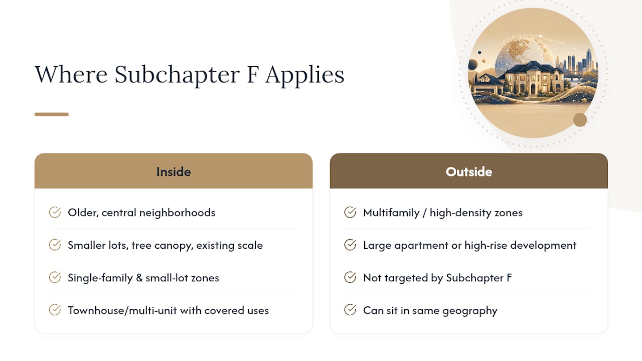
Subchapter F’s boundary tracks Austin’s older, centrally located neighborhoods rather than the entire city. That includes large stretches of the urban core where lot sizes, tree canopy, and existing housing scale were the original reasons the ordinance was adopted in the first place. Areas like Tarrytown sit squarely within the mapped footprint, where new construction routinely has to account for the tent plane and FAR cap together.
Zoning types affected skew toward single-family and small-lot single-family districts, along with townhouse and multi-unit residential designations that permit the covered use types. Multifamily zoning built for larger apartment or high-density development generally sits outside Subchapter F’s intent, even when it falls within the same general geography, because the ordinance targets house-scaled residential construction specifically.
Peer-city research on similar ordinances frames this kind of targeted boundary as typical: cities that adopt McMansion-style controls tend to apply them to established, lower-density residential areas rather than city-wide, since the goal is compatibility with existing scale, not a blanket size cap everywhere. Austin’s approach fits that pattern closely. If you’re evaluating a lot near the edge of the mapped area, don’t rely on neighborhood reputation. The boundary line itself, checked against the city’s map, is the only thing that determines whether Subchapter F applies.
A Local Take on What Actually Trips People Up
The part of Subchapter F that catches people off guard isn’t the FAR cap. It’s the tent plane, because it’s the hardest control to visualize without a drawing in front of you, and it’s the one most likely to force a redesign after money has already been spent on plans. My advice hasn’t changed in years: model the tent plane before you fall in love with a floor plan, and talk to someone who has been through this specific process on this specific type of lot. The ordinance isn’t going anywhere, and neither is the value of catching a conflict in week two instead of month four.
— Mike
Sources
- Anti-Mansionization in Austin, TX (2026) | CityRuleLookup
- SUBCHAPTER A. - ZONING USES, DISTRICTS, AND MAP; District designations | Municode Library
- City Council resolution initiating amendments to eliminate RDCC (EDIMS doc)
- McMansion Ordinances/Overlay Zones Limiting Square Footage | USDN Sustainable Consumption Toolkit
FAQ
Does the McMansion Ordinance still apply in Austin in 2026?
Yes. Subchapter F remains fully in force wherever it’s mapped, with its FAR/GFA cap, 32-foot height limit (35 feet in the floodplain), and 45-degree tent plane all still enforced during permit review.
What qualifies a house as a “McMansion” under Austin’s ordinance?
Subchapter F doesn’t label specific houses as McMansions. It sets numeric caps on floor-to-area ratio, height, and setback planes that any covered residential project must meet, regardless of style or size intent.
Can I still get a waiver if my design exceeds Subchapter F limits?
Waivers are possible but harder to secure since the Residential Design and Compatibility Commission was phased out. Requests now typically go through the Board of Adjustment, which applies a stricter hardship standard.
Which Austin neighborhoods fall under Subchapter F?
Subchapter F covers most of Austin’s central urban core, generally bounded by major roadways and the Colorado River, applying to single-family, small-lot single-family, townhouse, and similar residential use types within that mapped area.
What’s the fastest way to check if my lot is subject to Subchapter F?
Check the city’s official Subchapter F map, confirm the parcel through the Development Services lookup tool, and verify zoning on the property record. All three should agree before you finalize design plans.
Recommended
- Austin ADU Regulations: What Homeowners Need to Know in 2026
- What Today’s Luxury Austin Buyer Really Wants in 2026: Architecture, Tech & Outdoor Living
- What Austin Luxury Home Buyers Want in 2026: Architectural Styles, Tech, and Outdoor Living
- Luxury New Construction in Central Austin 2026: Your Guide to Tarrytown, Rollingwood & Westlake